
Live Wind information, refreshes automatically every 1-Minute, from all Attersee Wind & Weatherstations
Live maps can be configured by URL to show only selected stations:
LiveMap - Weather buoys
LiveMap - Sailors favorites
Live Wind information, refreshes automatically every 1-Minute, from all Attersee Wind & Weatherstations
Live maps can be configured by URL to show only selected stations:
LiveMap - Weather buoys
LiveMap - Sailors favorites
5-Day weather forecast that aims to adjust the excellent forecast baseline from Tomorrow.io with local thermal effects, such as Rosenwind, based on empirical knowledge right now, maybe AI in the future.
The actual wind data is retrieved from the 3 weather buoys and mapped to north (Buoy Kammer), mid (Buoy Attersee), south (Buoy Stockwinkel). Rain and overall weather data is leveraged from station Kammer.
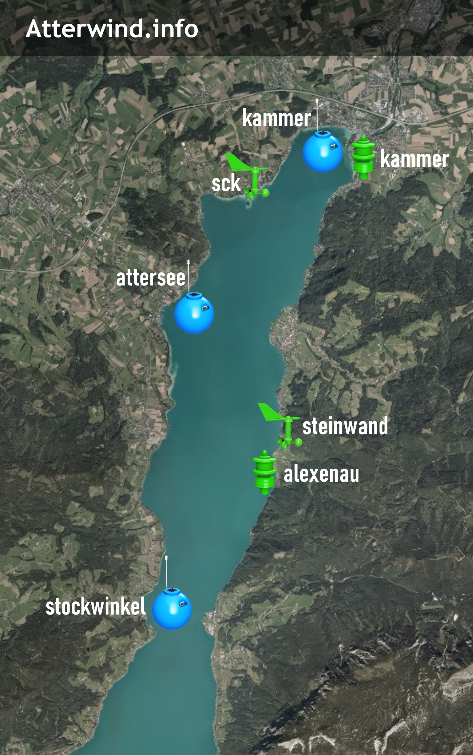
Buoys: 3 solar powered buoys equipped with ultrasonic weatherstation and open-source electronics:
wind, solar, air, water.
Sponsored by attersailing.at and
operated
by
UYCAS and atterwind.info.
Kammer: Private ultrasonic weather station on building roof in Kammer-Schörfling, approx. 20m distance from lake-shore and about 8m above Attersee lake waterlevel. Wind, Solar, Air, Rain, Water.
UYCAS: Ultrasonic Wind measurement on regatta startboat viribus unitis, as well as regatta support boat Windrose. Only visible during regattas and training.
Alexenau: Sailing-Club Weyregg, located at the peer on top of the yacht crane: wind, solar, air, raing, water.
SCK: Segelclub Kammersee, located at the peer in 10m height: wind, solar, air, water, webcam.
Steinwand: Weyregg-Steinwand, private, located at shore: wind, solar, air, rain, water
Atterwind.info is provided privately funded as community-service for free, ad-free, for non-commercial use. There is no guarantee for accuracy or availability of this data. No liability is assumed.
Weatherdata from UYCAS, SCK, Alexenau, Steinwand are kindly provided without any liabilities assumed and without any guarantee of correctness or availability.
Water level data was kindly provided by Hydrographic services upper austria. This measurement station is positioned in Kammer-Schörfling. Their legal notices apply.
Solar powered weatherbuoys: Weatherbuoy Open-source project on Github
Baseline Forecast thankfully provided by Tomorrow.io.
10h, 36h and 60h forecasts are retrieved daily at 8:05am,
the 24h forecast is retreived daily at 6:05pm.
Weather warnings are provided by GeoSphere Austria


